Democratizing access to NASA data for farmers

Designing an intuitive tool that empowers farmers to explore and analyze data to improve their farming practices. iFarmer enables farmers to generate accurate crop analysis reports by searching for and selecting specific cultivation areas.

Roles

Product Designer & User Researcher

INDUSTRY

Agriculture

Year

2025

Duration

2 months

Overview

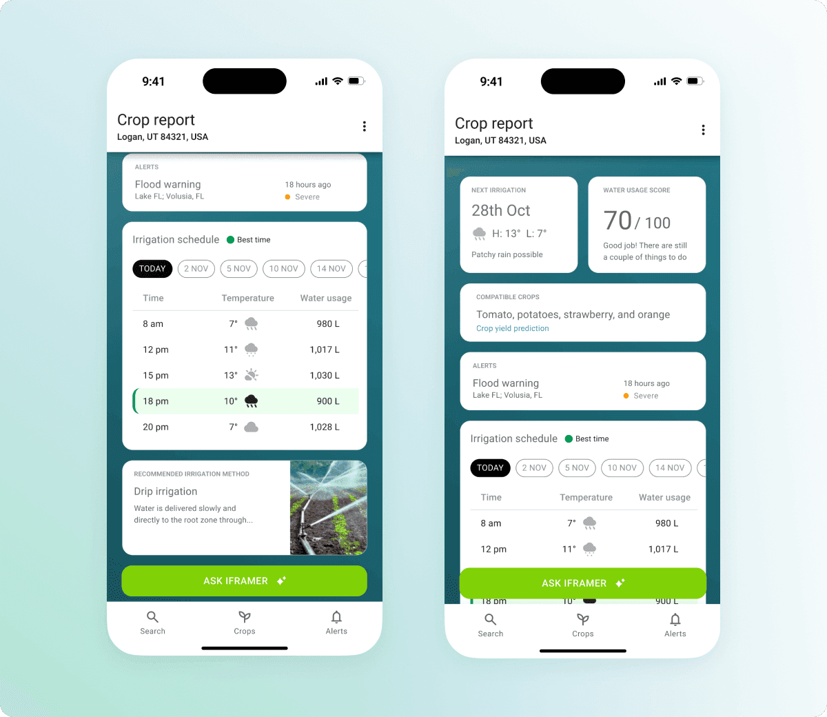
In 2024, I participated as a Product Designer in the NASA Space Apps Challenge. During this hackathon, my team and I developed iFarmer, an app inspired by the theme “The Sun Touches Everything.” The app collects key data points, including available water sources, estimated water requirements (in gallons, liters, or cubic meters), last irrigation date, irrigation method used, and crop type (e.g., beans, potatoes, strawberries). Our AI-based system processes this information to generate clear, actionable reports that allow farmers to make better decisions.

Challenges

NASA has the challenge of making accessible all the raw data that they collect through their satellites; therefore, we identified and targeted three critical challenges in modern agriculture where farmers can use this data to leverage their crop performance:

  • Unpredictable weather patterns are disrupting planting and harvesting schedules

  • Pest infestations are damaging crops and reducing yields

  • Prices of specialized services to improve crop irrigation systems are not affordable for independent farmers.

Solution

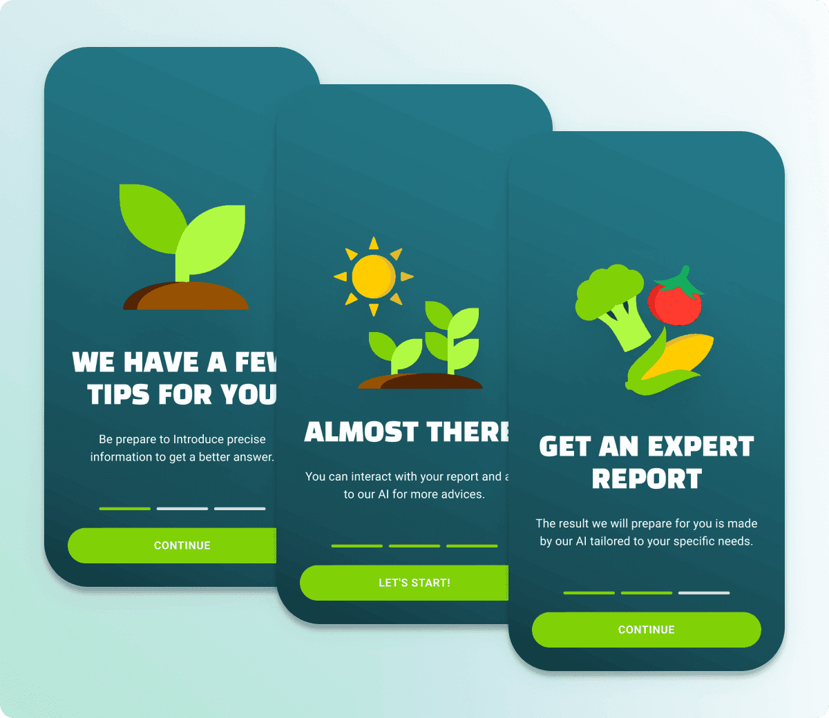
After interviewing farming experts and soil scientists, we designed a user flow that farmers can navigate confidently, even without prior experience using digital tools.

Onboarding for Farmers

To make the experience approachable for farmers unfamiliar with agricultural technology, we introduced an informative onboarding section outlining each step of the process.

Onboarding for Farmers

To make the experience approachable for farmers unfamiliar with agricultural technology, we introduced an informative onboarding section outlining each step of the process.

Onboarding for Farmers

To make the experience approachable for farmers unfamiliar with agricultural technology, we introduced an informative onboarding section outlining each step of the process.

Searching and Mapping a Crop Area

Searching and mapping a cultivation area is the core functionality that provides geospatial information to the system. Farmers can either enter a specific address or browse the map to locate their fields, then mark approximate boundaries using coordinates.

Searching and Mapping a Crop Area

Searching and mapping a cultivation area is the core functionality that provides geospatial information to the system. Farmers can either enter a specific address or browse the map to locate their fields, then mark approximate boundaries using coordinates.

Searching and Mapping a Crop Area

Searching and mapping a cultivation area is the core functionality that provides geospatial information to the system. Farmers can either enter a specific address or browse the map to locate their fields, then mark approximate boundaries using coordinates.

Collecting Crop Information

To capture real-time crop performance data, the app guides users through a series of questions about their irrigation schedule, water consumption, source of water, crop type, and irrigation methods.

Collecting Crop Information

To capture real-time crop performance data, the app guides users through a series of questions about their irrigation schedule, water consumption, source of water, crop type, and irrigation methods.

Collecting Crop Information

To capture real-time crop performance data, the app guides users through a series of questions about their irrigation schedule, water consumption, source of water, crop type, and irrigation methods.

Drafting a Crop Performance Analysis

Once users submit their crop information, our system processes the data and generates a segmented analysis with actionable insights tailored to the farmer’s context.

Drafting a Crop Performance Analysis

Once users submit their crop information, our system processes the data and generates a segmented analysis with actionable insights tailored to the farmer’s context.

Drafting a Crop Performance Analysis

Once users submit their crop information, our system processes the data and generates a segmented analysis with actionable insights tailored to the farmer’s context.

AI Assisted Guidance

Recognizing that small farmers often lack access to professional advisory services, we integrated an AI assistant to guide them through the recommended actions when implementing improvements.

AI Assisted Guidance

Recognizing that small farmers often lack access to professional advisory services, we integrated an AI assistant to guide them through the recommended actions when implementing improvements.

AI Assisted Guidance

Recognizing that small farmers often lack access to professional advisory services, we integrated an AI assistant to guide them through the recommended actions when implementing improvements.